![]()
The Poona Community Progress Association Inc. (PCPA), is there to support our community and takes serious its obligations in representing the community at all levels of government. As a community we continue to grow and evolve as an idylic beachside location and with a desire to make our town more liveable and ensure the town receives its share of services and amenities. Of significance though, we have somewhat unique issues associated with an ageing demographic with distance to services.
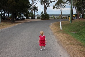
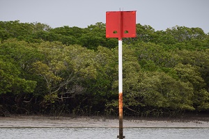
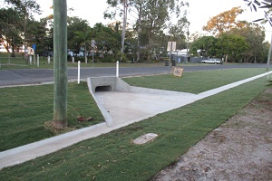
Faced with a range of issues affecting the community, in 2016, our community came together to shape a 10 year town plan. Being a '10 Year Plan' - the community considered what Poona should look like in the 2030s. Below are some comparative images aimed to prompt thinking of how Poona shapes up against neighbouring communities. The top images are existing photos of Poona and second demostrating alternative appearances, more of the norm in other communities.
The Town Plan was formally adopted by Fraser Coast Regional Council in 2020 and now into 2025 it's timely for the community to review what has been done; what hasn't been done, and why. Akin to the process undertaken in 2016 the Poona community will again be invited to make contributions/comments etc ahead of open workshops to discuss and set a forward plan.


Poona Infrastructure Planning - The Process
This page is designed as a medium to share facts and follows the evolution of concerted efforts on behalf of our wonderful community. Over many decades, all actions have had broad support of the majority of residents and since 2016 all actions undertaken have followed agreed actions established at open community workshops and actioned by the PCPA in accordance with those determinations.
Please note - the planning sub-committee has always operated with full community transparency and this webpage was specifically designed for that purpose where everything is laid out in chronological order (follow the tabs through the years).
For clarification of any aspects or general enquiries please contact the Infrastructure Planning Sub-Committee (IPSC) by email.
Poona's Infrastructure Timeline 1960s 1970s 1980s 1990s 2000s 2016 2017 2018 2019 2020 2021 2022 2023 2024 2025 2026 Below is a summary of actions in chronological order and incorporating links to supporting information and to downloadable, key documents. 1960s In 1967, the original 640 acres of freehold land was sub-divided with a section on Outridge Avenue/Boronia Drive (29 lots) going to auction. The balance of the parcel of land was sold to the Poona Palms Pastoral Company. |
|
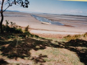
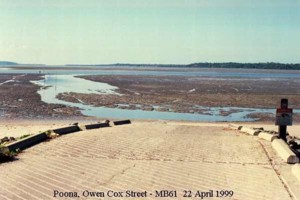
1970s A channel was dredged in the 1970's (Owen Cox St) by the Poona Palms Pastoral Company for the specific purpose to load and unload cattle. The channel was quite a way out from high water mark. The spoil was used as fill in the caravan park with the park owned by the pastoral company. Return to Timeline Beginning Return to previous section Return to Top |
|
1980s The dredged channel was accessed by local fisherman directly from the foreshore (no ramp). Through these early years the community strongly advocated for a proper boat ramp. Return to Timeline Beginning Return to previous section Return to Top |
|
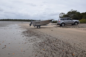
1990s In 1992, the developer (Forrester Kurts) acquired from the Poona Palms Pastoral Company a 230ha site at Poona. The land had approval for 144 residential blocks. The Maryborough City Council (MCC) had strongly opposed any development in Poona but their decision is understood to have been overturned on court application. Poona started to develop with nicely constructed housing blocks and the town started its growth. In 1994, the first actions were taken on preservation of the Great Sandy Strait for environmental protection. The boat ramp was becoming less usable due to the silting of the channel. The PCPA through the second half of the decade lobbied to get the channel dredged. See historic photos. The MCC, with the financial backing of the developer (Forrester Kurts) had applied for dredging of the channel and an upgrade of the ramp but that request was denied by Fisheries Department on environmental grounds. MCC lodged an Appeal to the Fisheries Tribunal and a public meeting was held at the boat ramp demonstrating the community's desire to have the channel dredged. Issues arose in the community with a long-time resident opposing the dredging purportedly because it would only attract more boats to the area and take the fish. The resident, ignoring the community's desires organised a petition with 70 signatures against the proposal. The consequence being that MCC withdrew the Appeal and the project shut down. In 1999, with environmental interests of the migratory shorebirds, a Ramsar Wetland Area in Great Sandy Strait was declared. Return to Timeline Beginning Return to previous section Return to Top |
|
2000s Early in this decade the new land developer sought to decrease the planned block sizes on the balance of the estate (higher density living). The community strongly objected on environmental grounds having particular regard to the agreement governing the world heritage status of the Strait. Legacy storm water issues were another factor. Strong lobbying resulted in the proposal being overturned. Two more concerted efforts were made in this decade by the PCPA to get the channel dredged with the last effort focussed on safety, should there be a serious bushfire. Council and the State Government continued their stance that the area was environmentally sensitive and would not gain the necessary approvals from the environmental agencies. In 2006, the Great Sandy Strait was declared a Marine Park. In 2008, the MCC was amalgamated into a larger conglomerate, the Fraser Coast Regional Council (FCRC) with management moving to Hervey Bay and over time, a community perceived view that there was less interest in the towns on Sandy Strait (refer to table of Poona's gains/losses). Return to Timeline Beginning Return to previous section Return to Top |
|
2016 General community displeasure remained as to be the 'poor cousins' when it came to infrastructure, including the sub-standard boat ramp. Colloquially, the ramp was referred to as the 'boat ramp to nowhere'. Concerns were expressed as to the need to cater for both a growing and an ageing community (refer to population data). The depressed land values in Poona, in comparison to our neighbouring communities (>30% difference), was clearly a concern as is the case for most people, their home was their greatest asset. Many residents forced to relocate because of health issues were faced with significant financial shortfall in purchasing elsewhere. Refer to property data Issues were identified and a stand out was a lack of infrastructure since the developer had gone and FCRC generally reducing services to the town (eg blue waste transfer bins, removal of second toilet block, foreshore management, closure of green waste dump). A dedicated Infrastructure Planning Sub Committee (IPSC) was established under the auspices of the PCPA. Initial enquires with MSQ indicated that GHD Consulting had been engaged to undertake the latest Statewide assessment of boating infrastructure needs. The IPSC made a comprehensive formal submission to that study and focussed on 3 important elements – economic, social and safety for an improved boating facility in Poona. Return to Timeline Beginning Return to previous section Return to Top |
|
2017 Initiated by the IPSC, the community was asked to ‘have a say’ on what our town needed and all those inputs were collated into a database and presented without opinions/recommendations etc. to the first workshop.
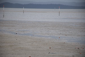
For more information refer to the section on Community Workshops/Open Meetings Collectively, these Pillars focussed on the community’s identified needs as a growing and ageing community. One of the 10 Pillars was an improved boating facility and seen as integral to a future plan. Analysis of tide and wind data showed a ramp that had very limited access. In fact, studying the 2016 Bureau of Meteorology (BOM) data showed that the ramp was only usable for 48% of daylight hours and when wind was taken into account (direction & strength) that percentage was reduced to just 29%. Looking at it another way a fisher wanting to access the Strait on weekend mornings, over the entire 2016 calendar year that was only achievable on a ratio of 1 out of 9 weekends. Initial enquiries with FCRC and MSQ, there was consistency in response that there was no way any dredging would be undertaken at the existing boat ramp because of environmental impacts and the situation was perceived to be even greater now that the Strait was part of a Marine Park MSQ released the GHD recommendations in May 2017 (Queensland Recreational Boating Facilities Demand Forecasting Study 2016) and based on the IPSC submissions, boat registrations, regional growth etc. identified Poona as a ‘Priority 1’ (as soon as possible). Of note, in prior Forecast Studies, Poona never previously even ranked a mention. However, this particular Study made a recommendation of an entirely new facility on Poona Creek. This was the first inkling of an alternative. For more information refer to the section on Boating Demand Forecast Study 2017 The IPSC made subsequent written submissions to both FCRC and MSQ outlining Poona’s need accepting at that time the Creek option was all that could be considered. There were misconceptions in FCRC that there was no value in a ramp on the creek as there was no difference to be gained in tide access, a position at on-site meetings debunked by local fisherman and evidence produced of a drone video taken on a spring low (dead low water). Watch the Video (38mb) MSQ officers inspected the site on the creek and held a meeting with the PCPA outlining issues and the way forward. The IPSC was invited to make a personal/formal presentation 29 May 2017 to a Councillor meeting detailing both the need for an improved boating facility and also the need for a new town plan covering the spectrum of the identified Pillars. There was clear support at that meeting from the Mayor and Councillors. With continuing reservations of FCRC it was eventually agreed to undertake a joint Feasibility Study with the proposed boat ramp. MSQ was to evaluate all the water/ramp matters and FCRC the car parking and land tenure aspects to form the joint study outcome. At this stage, MSQ/FCRC had the Owen Cox St ramp completely out of scope for any expenditure, other than routine maintenance. Concurrent with the boat ramp actions, the IPSC continued lobbying for an agreed town plan making many submissions and holding numerous meetings at all levels. Return to Timeline Beginning Return to previous section Return to Top |
|
2018 Despite the agreed community position on the 10 Pillars and all the work that had already progressed, in April 2018 one resident emerged and strongly advocated that the proposed new boating facility should be on Poona Point, not on the creek nor an upgrade of the existing Owen Cox St ramp. Subsequently, discussed at length at community general meetings to which there was no indication of any community support for the idea. The alternative was well and truly addressed and dismissed as an option on environmental and economic grounds. Marine Parks about this time released a ‘green paper’ regarding protection of rocky headlands on the Strait. Poona Point is one such rocky headland. MSQ completed their hydrographic work and the raw data confirmed that the site on Poona Creek offered far greater access than the existing ramp or other possible foreshore sites. MSQ advised also that as with the existing ramp, any other foreshore location experienced the same obstacles (wind, dredging etc). Preliminary geotechnical assessments undertaken and initial cultural assessments did not identify any matters of concern. Return to Timeline Beginning Return to previous section Return to Top |
|
2019 Early in 2019 changes were proposed to the marine park and the Association, whilst encouraging individuals to make submissions expressing their individual views, the Association took a high level approach in a formal submission, focussed only on the community elements (eg erosion). The Marine Parks submission can be viewed/downloaded With the progression of the boat ramp Feasibility Study, FCRC generally failed to meet stated deadlines as part of its commitment. With the town planning, agreement was eventually reached with FCRC to engage Archipelago Consulting, a well credentialed firm of town planners. On 25 October 2019 Archipelago led a terrific community workshop (over 100 attendees) but in the absence of the completed Feasibility Study a town plan could not be finalised. Return to Timeline Beginning Return to previous section Return to Top |
|
2020 COVID emerged and impacted progression of all aspects associated with the Town Planning and the boat ramp. At the same time, a level of disquiet on the Poona Creek proposal gained momentum and social media was used along with various letter box drops to discredit the plan of a boat ramp on Poona Creek. Disinformation was promulgated as to the unsuitability of the proposed site particularly citing the height of the cliff. The reality was that the site was on the gully adjacent to the cliff and was the former leasehold land upon which 'Tiger' Thompson had a creek side hut until the 1990s. The campaign was fabricated rubbish and lacked any true substance but nonetheless effective in causing dissention. In the backdrop of those differing positions of a minority, a further community workshop was convened on 29 February 2020 (over 150 attending) and this followed the release of the joint Feasibility Study. It was a combined Archipelago, MSQ, and FCRC presentation. For more information refer to the section on Community Workshops/Open Meetings
At the same workshop, a comprehensive town plan was presented by Archipelago and well received seeking to have infrastructure improvements with the underlying approach to maintain Poona’s natural appearance (minimal concrete/bitumen). Following this presentation of a draft plan to the community, FCRC at its meeting on 25 November 2020, formally adopted the Plan as a component of its town planning suite of documents. With the Poona Creek boat ramp signed off by Council in June, FCRC executives at a meeting 29 October 2020 advised that land tenure was a key topic in light of the relevant parcel of land for the boat ramp car park having recently been handed back to the Butchulla people. Return to Timeline Beginning Return to previous section Return to Top |
|
2021 On 5 February 2021, a meeting regarding boat ramp progress was convened at our MLA’s office and attendees included FCRC representatives. The FCRC representatives emphasised that there needed to be consultation with changes to an Environmental Reserve and there is also the consideration of Butchulla interests. The tenure aspect needed to be dealt with first even though it was an aspect that should have been done as a consideration in the Feasibility Study. Other advice conveyed to the IPSC was that a FCRC meeting with State Agencies indications were that ‘there did not appear to be the number of red flags previously thought’. No further meetings were held during 2021 and there were some COVID issues but we were led to believe matters were progressing with land tenure issues. FCRC wins a prestigious statewide award for community engagement associated with the development of the Poona Town Plan and boat ramp consultation. A small group emerged in opposition to the Poona Creek boat ramp proposal and ignoring the community's democratically determined decisions took up a petition over the Christmas break canvassing locals and visitors to have the existing Owen Cox St ramp upgraded. History repeating itself and giving government agencies opportunities for an 'out', as had happened also in other towns. To allay many of the concerns an open community meeting was held on 11 December 2021. Return to Timeline Beginning Return to previous section Return to Top |
|
2022 With all that had happened, noting nothing would be done at the Owen Cox St ramp and to work to get a better boating facility for Poona, the Feasibility Study completed and essentially a ‘shovel ready’ project for Poona, it became evident that FCRC failed in its undertaking to negotiate with the Butchulla traditional owners.
Instead of taking the matter further through due levels of consultation/negotiation, FCRC in the most dubious of circumstances simply seized on the reference of ‘cultural significance’ and totally withdrew from the project, accordingly advising MSQ of their decision. While not dismissing the comment around cultural significance, it is of note that the land at the proposed ramp site, under Native Title is ‘non-exclusive use area’. In contrast the area at the existing Owen Cox St ramp is ‘exclusive use area’ and that status extends the full length of the Poona foreshore. The big question to be answered - what information/facts about the Poona community's desires/requests had been conveyed to the Butchulla Elder to form such a view, and by whom? Also in 2022, Marine Parks called for submissions on proposed changes to the Great Sandy Marine Park. There were a number of contentious issues affecting all the local coastal communities including-
With the proposals, the community was encouraged to make individual submissions. Aware of the contentious nature of many of the proposals and affecting all the coastal communities the Association asked for direct community engagement before any proposals were adopted. Consultation Request Return to Timeline Beginning Return to previous section Return to Top |
|
2023 The adopted Poona Town Plan is a 10-year plan but implementation appears to be moving at glacial pace. Essentially nothing has progressed since FCRC sign off in November 2020. Beach erosion remains a serious concern for many and still no action or even the establishment of a consultative group and/or expert engagement. FCRC's advice in acknowledging delays has cited budget constraints. Whilst the 2023/24 budget had not yet been released, this position contrasts with the past budget years where both operating revenue and expenditure increased each year in the order of 6-8%. Then couple it with Poona volunteers, unlike many other communities on the Fraser Coast, doing a lot of work with FCRC workers eg. the Parks & Gardens Group that work to keep out town looking at its best (eg maintaining Market Alley and cul-de-sac gardens, public toilet rectification works). All that assistance saves FCRC financially or maybe the work just wouldn't otherwise get done. With the Poona Creek boat ramp proposal shut down and with no other viable options available in Poona, MSQ at the behest of our State Member, undertook to explore further what could be achieved at the Owen Cox St ramp, particularly some form of shallow dredging. A second Feasibility Study was undertaken that involved-
Those steps were completed in February 2023 and the outcome of the Feasibility Study was to be made available within a few months. If dredging was to be permitted, the way forward remained unclear as many other elements come into play including-
In addition, while we may at some point in the future achieve better tidal access, we will though still have a ramp severely exposed to wind (facing prevailing southeast winds without any form of protection). The latest Recreational Boating Facilities Demand Forecasting Study 2022 was released in May 2023 with Poona relegated to a 'Priority 3' and focussed on the existing Owen Cox St ramp but equally put greater emphasis on usage of the Tuan boat ramp. Whilst the Tuan ramp is only a distance by road of 16 klms, of greater concern is that it exposes drivers to the dangers of the Cooloola Coast Rd (logging trucks etc). The Fraser Coast section of the report can be viewed/downloaded The overall objective of the community was to gain improved boating access to the Strait, and whilst you could debate the pros and cons of the two sites it remains a positive to achieve any improvement. Return to Timeline Beginning Return to previous section Return to Top |
|
2024 In the previous year commitments were made to undertake a review of the 'no dredging policy' of the Owen Cox St boat ramp. That study was completed in February 2023 and finally a concept plan was provided to the PCPA on 13 April 2024. The plan proposed a dual boat ramp, fixed walkway and shallow dredging extending to the Poona Ck channel. The dredging spoil is to be used for foreshore renourishment in the area adjacent to the boat ramp. Note this was a concept plan and is yet to be subject of detailed engineering plans/specifications. The Concept Plan can be viewed/downloaded. On 8 June 2024 (PCPA General Meeting) the State Member (Bruce Saunders) reaffirmed that the existing boat ramp will be converted to a dual ramp with shallow dredging to facilitate greater access to the Strait. Bruce Saunders undertook to present further details at the PCPA July General Meeting but this did not eventuate.
Marine Park changes to be implemented On 11 May 2024 the State Member, Bruce Saunders provided the Community General Meeting with a summary sheet detailing Marine Park changes to come into effect from 21 May 2024. Clearly, these changes have broad implications for all fishermen and so too, those simply venturing out on the waters of the Great Sandy Strait. Of particular note is the speed in 'Go Slow' zones which has been reduced to 'less than 6 knots'. Certainly won't be a popular decision in the local areas of Poona, Boonooroo and Tinnanbar. Then there is the muted future changes of 'Seasonal Shorebird closure areas' and one would imagine that will impact the Poona area as well. Please review the The handout ' Information Sheet', and
Return to Timeline Beginning Return to previous section Return to Top |
|
2025 During this year things have got back on track with a number of concurrent activities
Great Sandy Strait Communities Consultation Group An outcome of the community workshop on 13 April 2025 were issues regarding the safety of people using the Cooloola Coast Rd and calls for upgrade with roundabouts etc. This is an aspect, also impacting the other coastal communities, so a request has been made for these to be added to the next meeting agenda. Erosion mitigation Background information on erosion; the State Government undertook a statewide review of the impacts of any rising sea levels. The work was conducted by consultants over several years and a suite of documents can be viewed on the FCRC website Coastal Hazards Erosion mitigation was one of the key actions of the Poona community, incorporated in the Poona Town Plan, signed off by the community and FCRC in late 2020. On 21 January 2025, Boonooroo Progress Association hosted an erosion mitigation meeting with representatives of all Sandy Strait coastal communities and with State Member John Barounis, Councillor Daniel Sanderson and FCRC CEO, Ken Diehm in attendance. Ken Diehm made it abundantly clear at the outset that FCRC will not address erosion issues other than in circumstances where public infrastructure is at risk. MLA John Barounis said he wants the allocated expenditure to go directly to works and each community is to assess it's most urgent need. We suspect that whatever is proposed it will need scrutiny and approval of relevant agencies (eg Marine Parks, FCRC) but it is positive that it is an election commitment and has the unequivocal support of the State Member. Our MLA, John Barounis in a speech to the Qld Parliament, has confirmed that $1.5m has been appropriated by the State Government for expenditure in 2025/26 on erosion control in Poona, Maaroom, Boonooroo, Tuan and Tinnanbar. The funds allocated will be equally distributed between the five communities. A video of the speech can be viewed on this link. This funding will not fix all the foreshore issues but with the planned re-nourishment of sand as part of the Owen Cox St boat ramp upgrade, it will be a good start on the mitigation. July 2025, in conjunction with our neigbouring coastal communities, discussions have commenced with the Butchulla Native Title Aboriginal Corporation (BNTAC) regarding approvals. The State Government has indicated the allocated funding (5 centres, $1.5m) is solely for capital works and cannot be used for consultancies. The Department of the Environment, Tourism, Science and Innovation (DETSI) has undertaken some preliminary assessments in Poona with a view to assessing options to stem further erosion on the foreshore. In the last round of Marine Park changes, the process for FCRC to undertake foreshore work has been streamlined. On the below map, the area shaded in blue denotes the foreshore now more directly under FCRC control.
Boat ramp upgrade With respect to the Owen Cox St ramp, on 22 January 2025, John Barounis together with Brent Mickelberg, Minister for Transport and Main Roads visited Poona and outlined MSQ's commitment to upgrading and dredging of the boat ramp with this construction works to commence by the middle of 2025. Subsequent to the above information, on 7 February 2025 the IPSC was advised by MSQ-
As at 7 April 2025, planned works with the boat ramp upgrade are proceeding as scheduled, with no particular issues of note. However, in early June 2025 we received advice of an area of Butchulla cultural significance near the boat ramp but on checking with the relevant authorities it was an area not impacted by the planned works and therefore, not an issue for concern. Unfortunately, the same information was circulated (not by the planning sub-committee) more than a month later, causing community alarm that the project had been scuttled. We can only reiterate, the area of cultural significance referred to, is definitely outside the planned works and the project, cleared by the Butchulla people, remains on track. That position, as stated, has been reaffirmed by MSQ in mid July and we will be advised in the near future with respect to the timing of dredging and construction. The planned upgrade went to formal government tender, closing on 17 July 2025, for the following defined works- POONA, QLD - Poona (Owen Cox St) Boat Ramp Upgrade and Access Channel Dredging - Upgrade to the existing Poona (Owen Cox St) Boat Ramp including construction of a concrete ramp, access way, floating walkway design and construction, access channel dredging and beach nourishment. The tender, at a cost of $2.041m, was accepted by MSQ on 29 July 2025. The principal contractor is the Brisbane based, Australian Marine and Civil. Construction work commenced as planned on 8 September 2025. Subject to weather etc. the closure will extend at least into December but the new facility should be opened for the Christmas holidays.
The new facility was opened on 18 December although further work is required in the new year.
Town Planning Return to Timeline Beginning Return to previous section Return to Top |
|
2026 Click the tabs to go to the relevant part of this section. Town Planing
Erosion In the addition to the above both the State Govenment and FCRC are believed to be considering other erosion remediation which could relate to the area on the Point to protect the Tree of Significance (Poona Pt Fig Tree). Funding is independent of the $30k related to the election commitment. Boat Ramp
With deep water access to this part of the Strait, it would not be unreasonable to anticipate much greater usage of the ramp by boaties from way beyond Poona, which will impact car/trailer parking and likely create congestion on Owen Cox St and Boronia Drive. Car/trailer parking is the responsibility of the FCRC and works must necessarily be timed after completion of the boat ramp and channel works. Return to Timeline Beginning Return to previous section Return to Top |